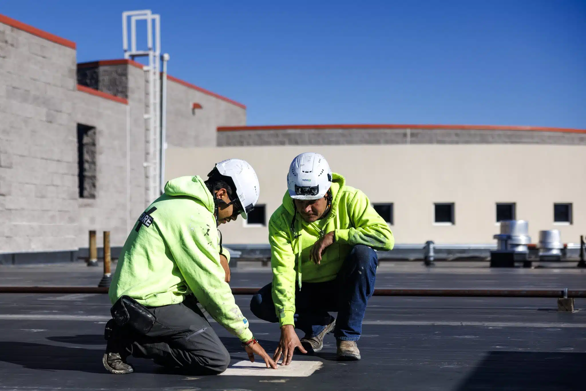
Inspect the entire roof without putting a crew on it
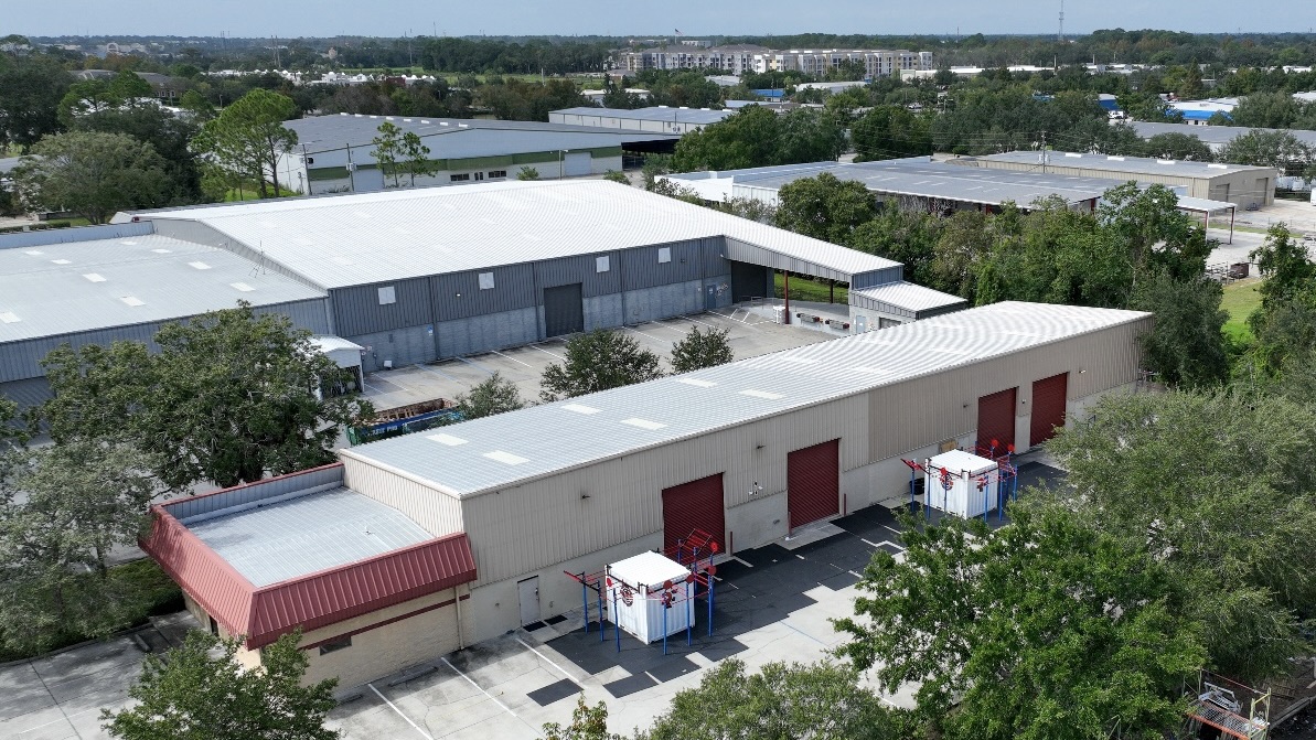
A single distribution building near the I- interchange can hold a couple hundred thousand square feet of low-slope membrane, and the traditional way of inspecting that - a crew walking the field grid by grid for the better part of a day - fights itself two ways. It is slow, and every step adds traffic to a membrane whose condition is the exact thing you hired us to assess. We fly these roofs instead. A drone carrying a high-resolution visible camera and a radiometric thermal sensor covers the whole surface in a fraction of the time, captures every drain sump, seam, curb, and equipment penetration from a steady altitude, and never sets a boot on a roof we have not yet confirmed is safe to stand on.
Raleigh and the wider Triangle are stacked with the building types this was built for. The freight and warehouse corridors off I-, the big-box retail strung up Capital Boulevard, the office and laboratory campuses inside Triangle research corridor, and the institutional roofs around the Raleigh campus campus and the Wake County government complex downtown all share the same profile: large, flat, hard to inspect honestly from the ground. A flyover hands an owner or facility manager a complete, repeatable visual record - the kind you can lay year against year to watch a soft spot develop instead of waiting for it to leak.
Thermal imaging is how we find the water you cannot see
The visible-light pass documents the surface: split seams, ponding rings, lifted flashings, displaced ballast, storm and equipment damage. The thermal pass reads what is happening inside the assembly, and on a commercial roof that is where the costly failures hide. Wet insulation carries far more thermal mass than the dry material around it. Through a sunny day the whole roof absorbs heat; after the sun drops, the dry areas shed it fast while the saturated zones hold onto it and glow warm in the infrared frame. Fly that cooldown window correctly and the moisture map you get back traces the precise shape and extent of the wet insulation sitting under a membrane that still looks intact from above.
That single distinction drives the biggest decision on any aging roof: patch a few discrete zones, recover the field, or tear it off and start over. Walk a 150,000-square-foot Triangle warehouse on foot and you will find the leaks that have already shown up over someone's inventory. Fly it with thermal and you also find the saturated areas that have not announced themselves yet - the ones that decide whether this is a contained repair this year or a full replacement in two. The Triangle's long humid summers and the heavy, drawn-out rain that rides in on hurricane remnants like Florence in 2018 and Helene in 2024 push water into these assemblies steadily, so here the gap between what is visible and what is actually wet tends to run wide.
Why the flight has to be timed
A thermal moisture survey is not a fly-whenever service, and any roofer who tells you it is has not done many. The contrast we depend on only develops under specific conditions: a day with enough solar gain to charge the roof, dry weather so the sensor is reading the assembly and not a film of surface water, and the cooldown after sunset when wet and dry zones separate most sharply. We schedule around that window and the local forecast rather than the calendar, and we confirm every suspect zone with a physical core so the report rests on verified findings instead of infrared alone.
We fly under Part 107, and Raleigh's airspace is why
Commercial drone work is regulated and we treat it that way. Our flights run under FAA Part 107 with a certificated remote pilot, and around here that is non-negotiable rather than a nicety. Roofs near RDU sit inside controlled airspace where a flight legally requires LAANC authorization, and the whole Triangle carries dense low-altitude helicopter traffic from regional healthcare campus, regional institution, and regional institution medical transport. We check the airspace, secure whatever authorization the location demands, hold the aircraft in visual line of sight, and brief the crew on the property below before launch. A roof inspection that turns into an air-safety incident is not one anyone wants attached to their building.
The ground-safety case is just as strong. Steep-pitched church and institutional roofs, roofs of uncertain structural condition after a storm, and roofs slicked with algae or morning frost are exactly the surfaces where sending a person up first is the actual hazard. The drone lets us assess all of it from the air and only put a technician on the deck once we know where it is sound and where it is not.
A report a facility manager can act on
The deliverable is the whole point. Every image is GPS-tagged, so a finding is not described as the southwest corner give or take - it is a located coordinate a repair crew can walk straight to. We assemble the visible and thermal imagery into a report that overlays moisture zones on the roof plan, flags surface defects by location and severity, and gives ownership a defensible basis for a repair-versus-replace decision and a real capital-planning number. For an owner carrying several Triangle properties, that consistent, dated record is what turns roofs from a reactive scramble into a budgeted line item.
After hail or a wind event the same flight becomes claim documentation. Aerial imagery showing impact density and storm-driven membrane displacement, captured and tagged across the entire roof, gives a commercial adjuster the located evidence they need and hands the owner something far harder to argue with than a handful of ground-level phone photos when the scope of a claim is in dispute.
Frequently asked questions
Why is a drone inspection better than someone walking the roof?
It covers the whole surface systematically from a fixed altitude, produces a complete dated photo record, and adds zero foot traffic to a membrane you are already trying to protect. On large low-slope roofs a walkover eats hours and still misses ponding zones invisible from standing height. Thermal moisture mapping in particular is not practical on foot - it needs the uniform aerial coverage only a flight gives.
Can thermal imaging really find moisture under an intact membrane?
Yes, under the right conditions. Wet insulation holds the day's heat longer than the dry material around it, so during the cooldown after sunset it reads warm on the radiometric sensor as a distinct zone. We confirm those zones with physical cores, and the resulting moisture map is solid enough to drive a partial-repair versus full-replacement decision.
Do you need FAA authorization to fly my roof in Raleigh?
Frequently, yes. We fly under FAA Part 107 with a certificated remote pilot. Roofs in the controlled airspace around RDU require LAANC authorization, which we obtain before the flight, and we plan every flight around the heavy medical-helicopter traffic moving across the Triangle.
What size and type of roof is a good fit for a drone inspection?
It shines on large flat commercial roofs - warehouses, distribution centers, big-box retail, office and lab campuses, multi-building parks. On a small or steeply pitched roof a manual look is fast and complete. As a rule of thumb, once a roof clears roughly 10,000 square feet or is hard to access safely, the flight is the better tool.
How fast can you get out for a post-storm inspection?
Routine surveys generally schedule within a few business days. Post-storm flights for claim documentation get priority and can often happen within a day or two of the event, weather and airspace permitting. The thermal portion still has to wait for suitable conditions to read accurately, and we will tell you when that window lands.
Map your roof before it surprises you
If you own or manage large low-slope roofs anywhere from Triangle research corridor to the Garner industrial corridor, a flown survey gives you a complete, located picture of surface condition and hidden moisture in one visit. Get in touch and we will schedule the flight around the right thermal window and deliver a report you can plan and budget against.